Moun­tain run­ning

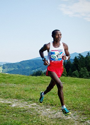
Start Vil­lage Square Egg (564 m) Fin­ish Niedere (1.586 m) Dis­tance 12 km Height dif­fer­ence 1116 m Peak 1680 m Route Asphalt, alpine mead­ows, hik­ing trails, exposed moun­tain edges, ridges, peaks

Impor­tant Infor­ma­tion

The pre­lim­i­nary route def­i­n­i­tion is sub­ject to change! The route is only open for inspec­tion! Train­ing is entire­ly at the risk of any par­tic­i­pant! Nor­mal obsta­cles such as vehi­cles, ani­mals, pedes­tri­ans, wood­work, stone chip­pings etc. are always pos­si­ble! Please be friend­ly and charm­ing with all farm­ers, landown­ers and ani­mals! Mark­ings: road mark­ings and flags. No climb­ing aids (spikes, sticks, etc.) allowed! Gar­ment bag trans­port is the respon­si­bil­i­ty of the paraglid­er of your own team! Return of the moun­tain run­ners on the day of the com­pe­ti­tion: at 1 p.m., 2 p.m. and 3 p.m. a bus to the cheese cel­lar at Lin­ge­nau leaves from the val­ley sta­tion of the moun­tain rail­ways at Andels­buch!

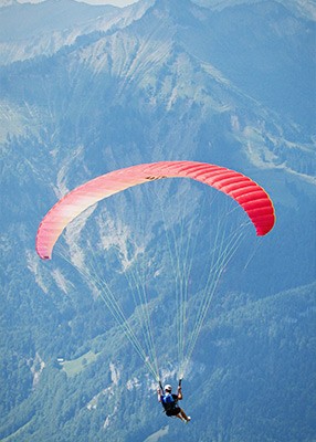
Paraglid­ing

Run start Vordere Niedere (1.548 m)
47° 24’ 12.00“N - 9° 56’ 18.85“E
Flight start Hin­tere Niedere (1.686 m)
47° 23’56.80“N - 9° 56’ 40.57“E
Direc­tion Andels­buch
47°23’56.89“N - 9°56’40.92“E
Direc­tion Bezau
47° 23’53.84“N - 9°56’39.07“E
Buoy Buoy short­ly before the Bers­buch climb­ing tow­er (605 m)
47° 24’ 4.74“N - 9° 51’ 28.02“E
Fin­ish Tar­get Fis­chte­ich - marked land­ing pad (589 m)
47° 24’ 12.47“N - 9° 52’ 21.89“E
Dis­tance 7.5 km Height Dif­fer­ence 1100 m

White­wa­ter kayak­ing

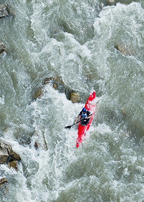
Start VKW pow­er plant Andels­buch / Bers­buch Fin­ish Train sta­tion Lin­ge­nau / HIGH 5 Dis­tance 6 km Riv­er Bre­gen­z­er­ach Dif­fi­cul­ty White water 3 Route 4 meters cliff start, slalom, water­fall, Egger Wehr, rapids, Eski­mo roll Kayak max. Length 380 cm, min. 15 kg, orig­i­nal boats only Mate­r­i­al HTP or PE, no Kevlar, coal, poly­ester! No keel!

Impor­tant Infor­ma­tion

The pre­lim­i­nary route def­i­n­i­tion is sub­ject to change! The route is only open for inspec­tion! The train­ing is entire­ly at the risk of any par­tic­i­pant! Nor­mal obsta­cles such as vehi­cles, ani­mals, pedes­tri­ans, wood­work, stone chip­pings etc. are always pos­si­ble!

The water res­cue is post­ed on the day of the com­pe­ti­tion at all crit­i­cal points.

Con­di­tions and dis­qual­i­fi­ca­tion rea­sons:
Each canoeist must wear a life­jack­et that com­plies with ICF rules. Equal­ly oblig­a­tory is wear­ing a hel­met and suit­able footwear (bare­foot is pro­hib­it­ed because of the risk of injury).

Slalom with one down­stream and 10 upstream gates. Dis­re­gard­ing the "Stop and Go" call to wait for the penal­ty time accu­mu­lat­ed over the entire course will be dealt with by dis­qual­i­fi­ca­tion of the entire team.

Moun­tain bike

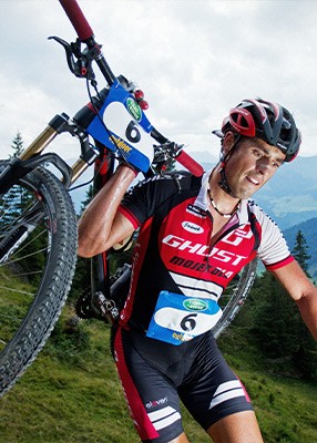
Start Train sta­tion Lin­ge­nau / HIGH 5 (490 m) Fin­ish Train sta­tion Lin­ge­nau / HIGH 5 (490m) Dis­tance 31.2 km Height dif­fer­ence 1636 m Route Asphalt, for­est roads, sin­gle trails, demand­ing portag­ing pas­sages, down­hill

Impor­tant Infor­ma­tion

The pre­lim­i­nary route def­i­n­i­tion is sub­ject to change! The route is only open for inspec­tion! The train­ing is entire­ly at the risk of any par­tic­i­pant! Nor­mal obsta­cles such as vehi­cles, ani­mals, pedes­tri­ans, wood­work, stone chip­pings etc. are always pos­si­ble!

Please be friend­ly and charm­ing with all farm­ers, landown­ers and ani­mals! Mark­ings: road mark­ings and flags.

Mark:
Ground mark­ings, flags, bar­ri­ers and mar­shals.

Route change:
Moun­tain bike - changed route for the last kilo­me­ters: Lin­ge­nau - Groß­dorf - Bre­gen­z­er­ach Bah­n­trasse - Fin­ish: an extreme­ly spec­tac­u­lar fin­ish in terms of the ath­letes and the spec­ta­tors.

Rea­sons for dis­qual­i­fi­ca­tion:
- Fail­ure to wear the hel­met
- Wheel mark not in order (2 x tires, 1 x frame)
- When not dri­ving the marked route
- Slip­stream­ing behind cars or for­eign bik­ers and sim­i­lar unfair actions!

Loca­tion & routes